
|
Palaiseau et Orme des Merisiers (France)
|
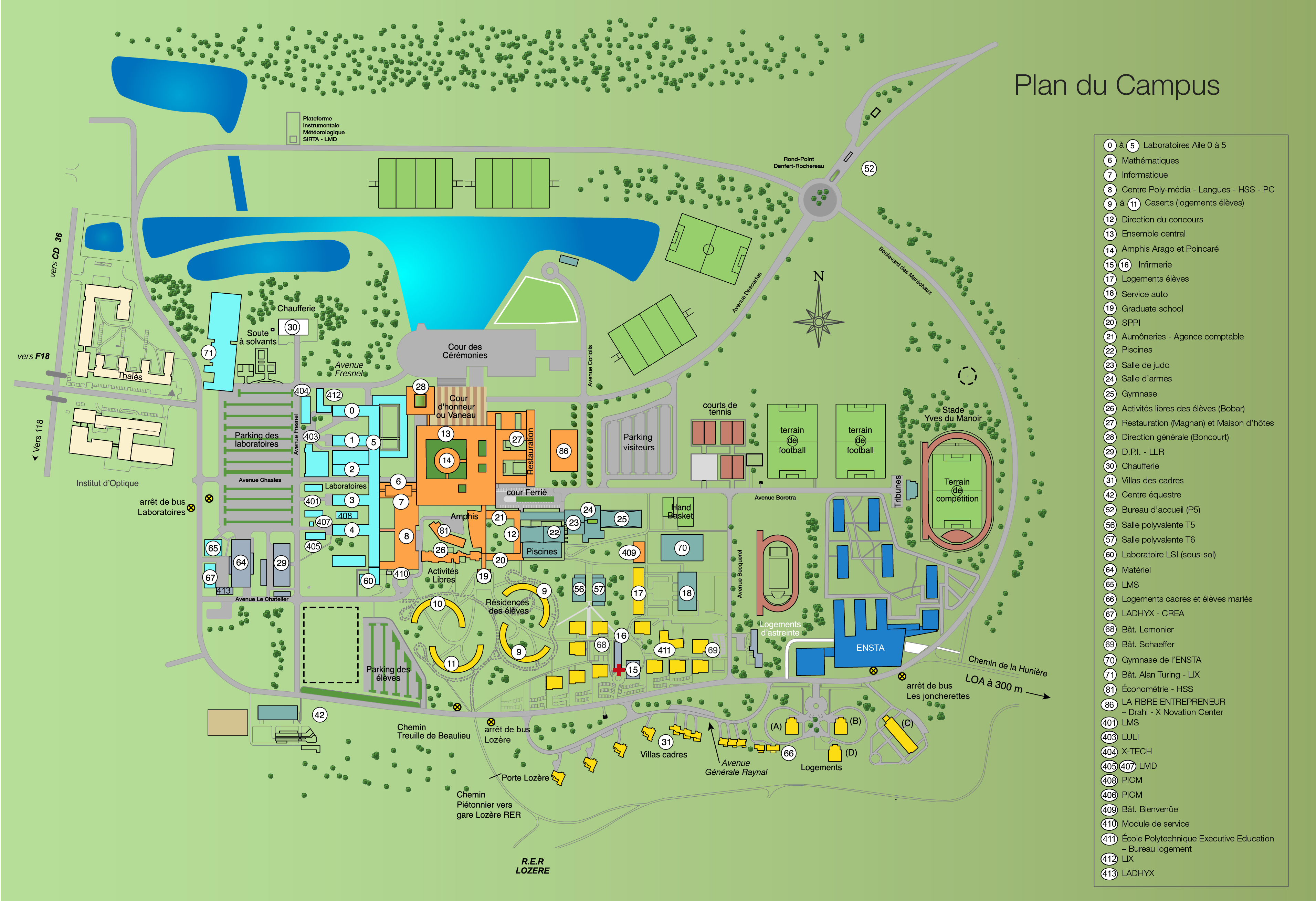
MapMaps and directionsJust 20 km south of Paris on a site spanning almost 160 hectares, the École Polytechnique can be reached from several access points. The site Campus Map of the École Polytechnique.
IMPORTANT: as the "vigipirate" security plan is still on, after the terrorists attacks in 2015, an identity card will be required in order to indentify you, at the entrance of the campus, or at any moment in the campus.
Access using public transport > RER B Massy-Palaiseau station > RER B Lozère station >Access by road
>Orientation in the campus |


